Ashghal introduces a new 3D-GPR system for road inspection.

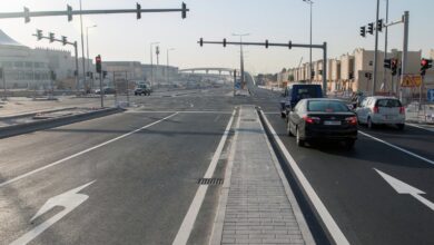
As part of the preventative operation and maintenance plans for Qatar’s road network, the Public Works Authority (Ashghal) has used the newest technology to scan asphalt using three-dimensional radar (3D-GPR) to check lower layers of roads, bridges, and the sewage network.
The Roads Operation and Maintenance Department at Ashghal Recently the high-end technology was also used on the Al Asiri Bridge and several other roads, highways etc to identify and fix any defects in the road layers.
The radar beams penetrate the asphalt surface layers to reach the bottom levels, identifying any flaws or holes in the foundations before they emerge on the surface. The deep scanning procedure is carried out with excellent precision, reaching depths of up to four metres below the earth’s surface.
“Ashghal uses this proactive approach to control the spread of these defects on the asphalt surface, thus reducing the impact on traffic, enhancing safety and traffic flow on roads, and reducing the cost of roads operation and maintenance,” said Eng Mohammed Al Khashabi from the Roads Operation and Maintenance Department.
He went on to say that one of the system’s advantages is the ability to create maps of infrastructure and utilities, as well as bridge problems and voids beneath roadways. More testing is planned for the near future in order to cover a broader variety of road networks and improve road user safety.
The three-dimensional radar (3D-GPR) employs variable frequency radar beams to perform high-resolution and three-dimensional mapping beneath the road surface by emitting radar waves and analysing reflections from various layers beneath the earth’s surface.
The GPR radar gadget is placed on the vehicle and captures data at a speed of 20 km/hr. The data is further examined using the ‘Examiner’ tool, which detects holes and other flaws.
The Laser Crack Measurement System (LCMS) scans the characteristics of the road surface layer to detect cracks, depressions, and other surface problems. When this data is coupled with (3D-GPR) data from the lower levels, full information on the operation of roads, bridges, and the sewage network is provided. Based on these findings, the dedicated technical team analyses the data and devises a suitable and timely preventative strategy to eradicate the source of the issue and limit its escalation.